


PRECINCT CESSNA, Hardin County, Ohio
About
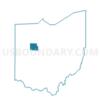
Outline

Summary
| Unique Area Identifier | 647852 |
| Name | PRECINCT CESSNA |
| County | Hardin County |
| State | Ohio |
| Area (square miles) | 22.86 |
| Land Area (square miles) | 22.86 |
| Water Area (square miles) | 0.00 |
| % of Land Area | 100.00 |
| % of Water Area | 0.00 |
| Latitude of the Internal Point | 40.70337000 |
| Longtitude of the Internal Point | -83.70406040 |
Maps


Graphs
Select a template below for downloading or customizing gragh for PRECINCT CESSNA, Hardin County, Ohio


Neighbors
Neighoring Voting District (by Name) Neighboring Voting District on the Map
- PRECINCT BLANCHARD, Hardin County, OH
- PRECINCT BUCK, Hardin County, OH
- PRECINCT LIBERTY B, Hardin County, OH
- PRECINCT LYNN, Hardin County, OH
- PRECINCT MARION, Hardin County, OH
- PRECINCT MCDONALD, Hardin County, OH
- PRECINCT PLEASANT B, Hardin County, OH
- PRECINCT WASHINGTON, Hardin County, OH
Top 10 Neighboring County Subdivision (by Population) Neighboring County Subdivision on the Map
- Pleasant township, Hardin County, OH (8,338)
- Liberty township, Hardin County, OH (7,712)
- Buck township, Hardin County, OH (2,449)
- Marion township, Hardin County, OH (2,440)
- Blanchard township, Hardin County, OH (1,533)
- McDonald township, Hardin County, OH (862)
- Washington township, Hardin County, OH (729)
- Lynn township, Hardin County, OH (572)
- Cessna township, Hardin County, OH (494)
Top 10 Neighboring Unified School District (by Population) Neighboring Unified School District on the Map
- Kenton City School District, OH (11,941)
- Ada Exempted Village School District, OH (7,951)
- Upper Scioto Valley Local School District, OH (4,236)
- Hardin Northern Local School District, OH (2,829)
Top 10 Neighboring State Legislative District Lower Chamber (by Population) Neighboring State Legislative District Lower Chamber on the Map
Top 10 Neighboring State Legislative District Upper Chamber (by Population) Neighboring State Legislative District Upper Chamber on the Map
Top 10 Neighboring 111th Congressional District (by Population) Neighboring 111th Congressional District on the Map
Top 10 Neighboring Census Tract (by Population) Neighboring Census Tract on the Map
- Census Tract 2, Hardin County, OH (4,750)
- Census Tract 5, Hardin County, OH (4,370)
- Census Tract 6, Hardin County, OH (4,060)
- Census Tract 3, Hardin County, OH (3,750)